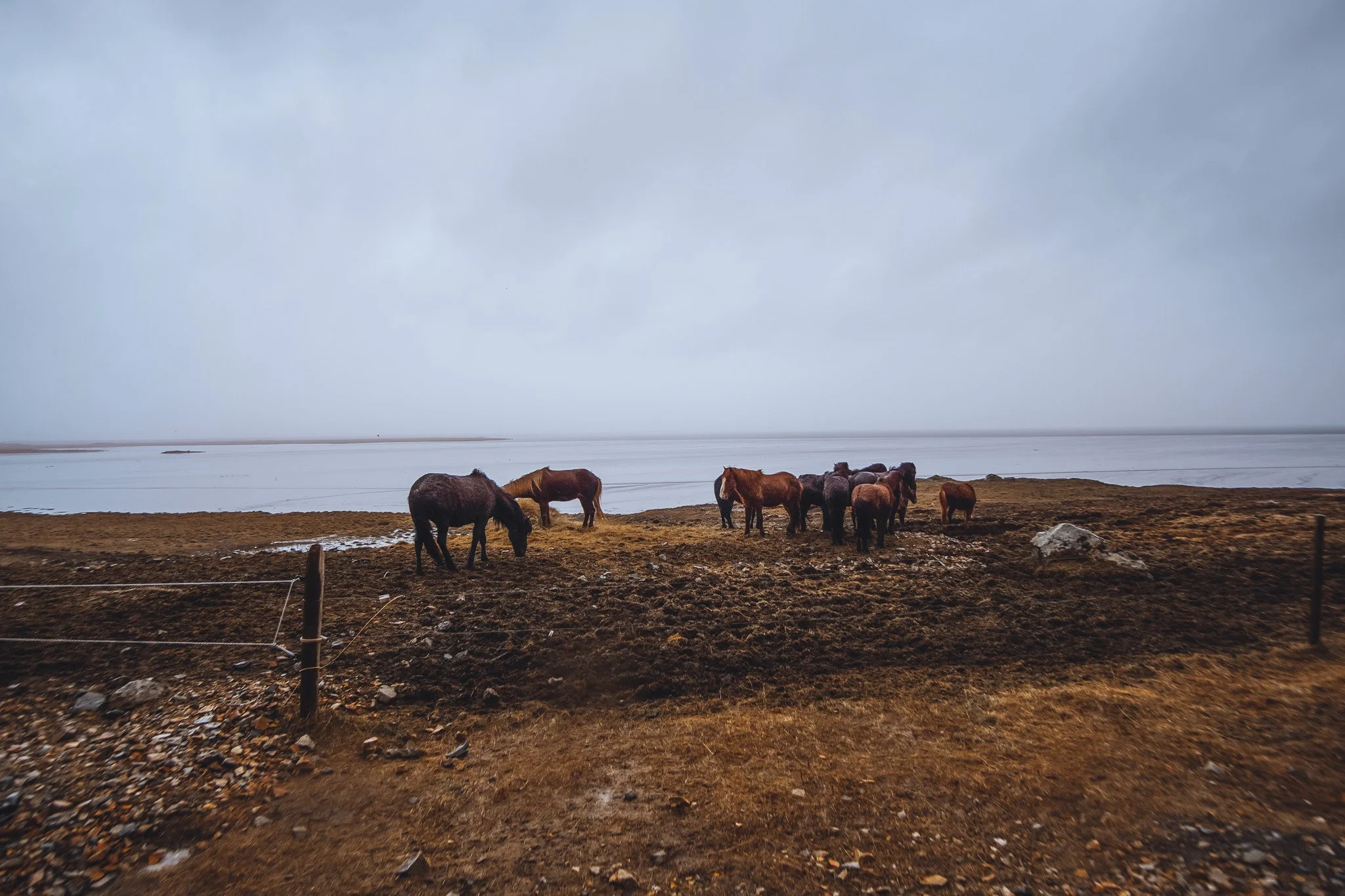
We set out north from Grundarfjörur and arrived at Eirksstair Viking Longhouse in time for sunrise. The 7-hour drive to our next accommodation in Laugar, had us driving through some incredible scenery. After crossing the river just beyond Varmahl, we turned left to take the northern route, an even more picturesque road, to Siglufjörur and Dalvik. This is a fantastic detour because of the snow-covered fishing villages set against the vibrant blue waters. Getting to photograph the towns with the mountains in the background and fjords in the foreground is a bucket list shot!

As we continued east, we came across the Vaðlaheiðargöng toll road, a tunnel that saved us lot of time (just pay online within 3 hours to avoid extra fees!). Then it was on to the day's main destination, Goðafoss. The walking trails provide easy access to the angelic waterfall with striking blue waters. There were quite a few people there due to its popularity, but I had no trouble finding locations to get great photographs while avoiding the crowds. We arrived in Laugar, home for the next three nights, a great base for exploring the surrounding area and cheaper than nearby Akureyri, Iceland's second largest city.
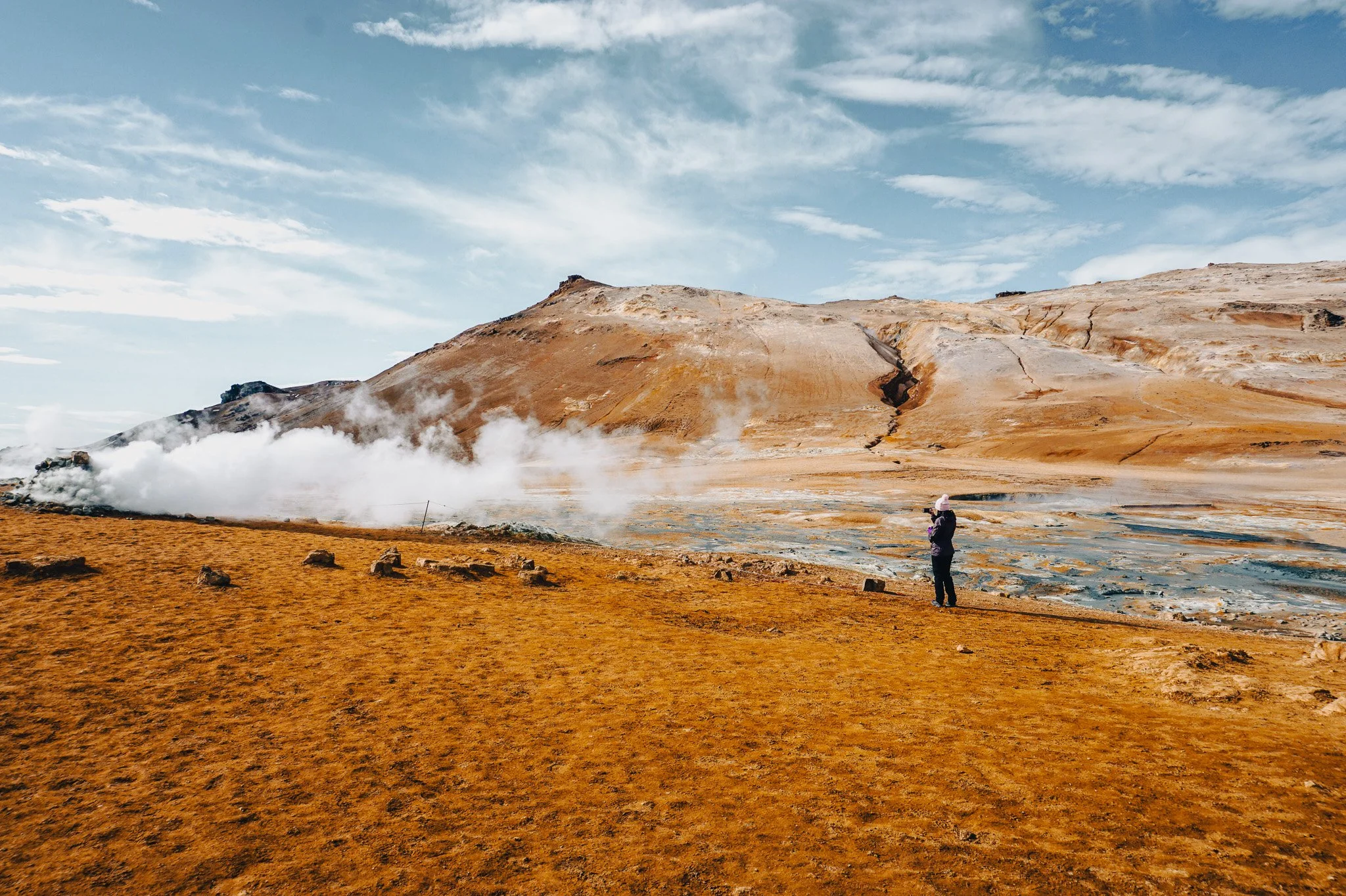
The following day we explored the area surrounding Lake Mývatn, travelling in a clockwise direction. Stepping into the Mývatn Geothermal Area is like landing on Mars. The ground is dry and rocky, with protruding volcanoes, surrounded by desert like beds and craters. Mt. Námafjall, an orange/yellow rhyolite mountain that towers over the geothermal area Hverir, was the first stop. Hverir is covered in large fumaroles, constantly billowing out gasses such as hydrogen sulphide. With the smells of sulphur, boiling mud pools and barren landscape it’s easy to understand why the locals refer to this place as Hell’s Kitchen.
Turning left off Road 1, we ascended past the Krafla Power Plant. Iceland is a country of renewable energy, and witnessing the steam this plant produces, it's hard not to be in awe of the power of nature. Fun fact, about 85% of all houses in Iceland are heated with geothermal energy. Then, continuing onto Krafla, a 2,130-foot-high barren active volcanic caldera with an icy blue crater lake. A stark contrast to the scorched landscape below.
A quick stop at Grjótagjá, a cave pool made famous by Game of Thrones. It used to be a popular bathing spot, until the 70s where a nearby volcano erupted, leaving underground lava heating the water at dangerous levels. It strictly says no swimming, but plenty of tourist take the risk. It reminds me too much of Dantes Peak scenario, so I stayed out. Then off to the lava fields of Dimmuborgir. Walking among these jagged rock formations makes you appreciate how difficult it must have been to settle in this land. This is an excellent location for photographing the Hverfjall volcano because it is far enough away to capture the entire landscape. We ended the day at Mvatn Nature Baths. These baths are an excellent alternative to the far more popular (and far more expensive) Blue Lagoon pools south of Reykjavik. We reserved our time slot ahead of time, then spent the rest of the afternoon relaxing among the surrounding volcanoes.
We only planned two main sites for the next day, as some rest was needed before our next big drive. Asbyrgi (Shelter of the Gods) is a spectacular horseshoe-shaped canyon. Viking settlers believed this to be a hoof-print formed by Sleipnir, Odin's eight-legged flying horse from Norse mythology. According to geologists, Asbyrgi formed as a result of a catastrophic flood from the nearby Jokulsa glacial river. As usual, we arrived just as the sun peaked above the rim, lighting up the basin full of snow.
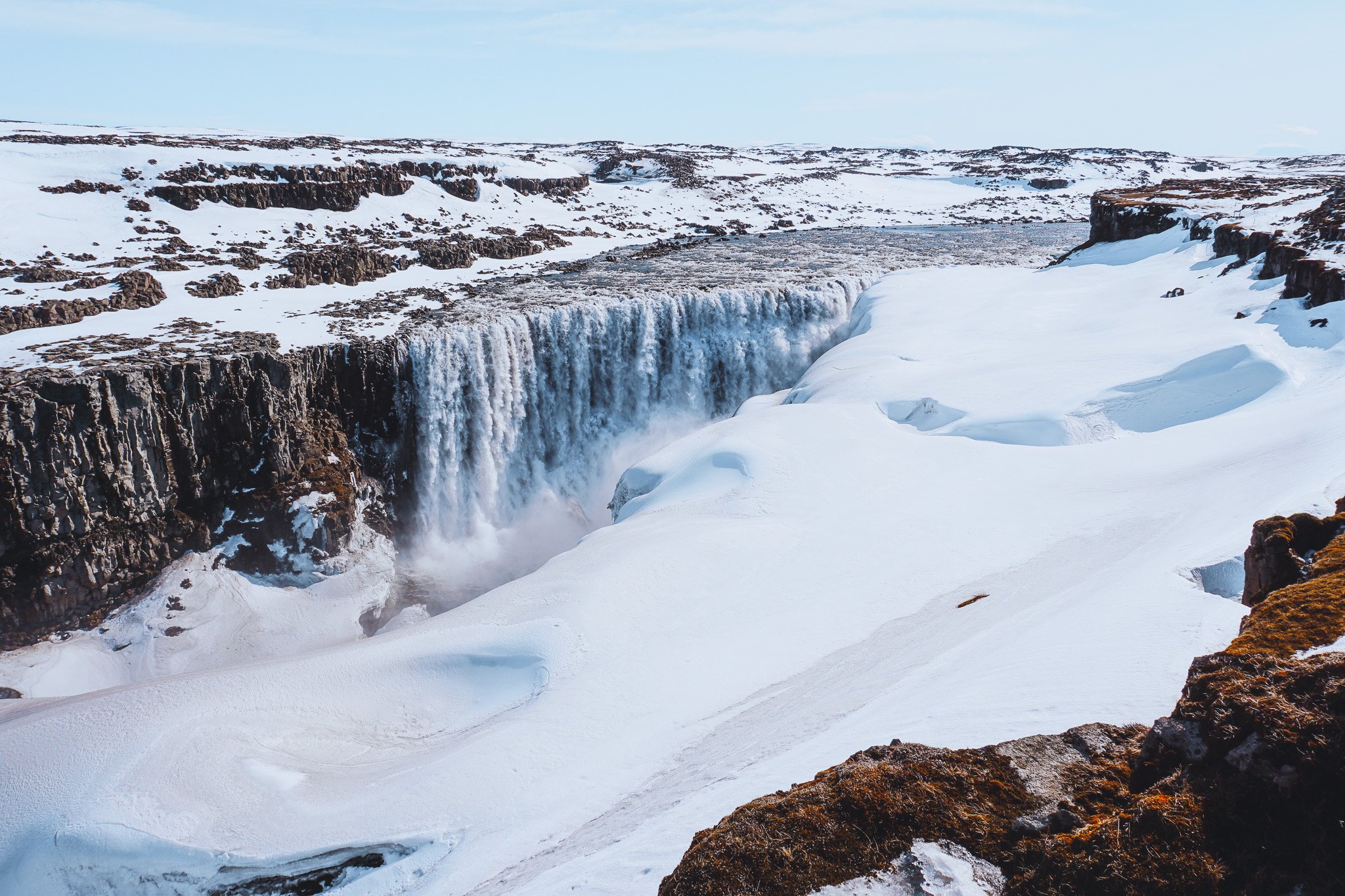
Dettifoss, the second most powerful waterfall in Europe after the Rhine Falls, is not far along the same road. The hike to the falls had only recently opened for the season, so we had to struggle through knee-high snow at times. Although difficult to photograph, due to the extreme contrast and light, seeing this waterfall surrounded by pure white was an epic experience!

In what turned out to be a difficult day, our 6-hour drive to our accommodation in Höfn turned into 9. We took a detour a few hours in to see Geirsstaðakirkja, a golden grass covered Viking church. Taking the road less travelled, hoping for a local scenic drive, we came across a snow rut. The snow rut was less than 2 meters wide and appeared to be the only obstacle in our way. Rather than turning around, we decided to drive over it, only to become stuck. 2wd cars and snow ruts don't mix, and we were in so deep that our axles were resting on the snow. We'd passed a farm a few kilometres before, so as I started digging, my wife Emily took off running towards the farm. Half an hour later, she returned as passenger in a farmer’s ute, who kindly helped towed us out with a snap strap.
My wife recalls running across flooded plains, with scattered sheep skeleton bones for 3 kms. Shoes soaked and out of breath she reached the farm gates. Approaching the farmers driveway 6 farm dogs came howling at her, finally getting the attention of the farmer, another 1km up a hill. The farmer indicated her to come-up, as she arrived at the front door of the cottage, she explained the situation and the farmer immediately knew exactly what she was talking about, as he also got stuck there the previous day. Now that I think about it, I probably shouldn’t have let my wife run off to a stranger’s house by herself, but thankfully the Icelandic locals are extremely friendly! After thanking him for his help and having a good laugh, we returned to the main road, embarrassed and slightly defeated.
Leaving Egilsstaðir we were forced to take Road 95, leading through Heidavatn, as the coastal route (Road 1) was closed due to the weather damaging the roads. This gravel mountain pass was extremely tricky, with dense fog only allowing a few metres of visibility. Add this to the narrow track and tight corners, my nerves were frayed by the time we descended below the cloud line.
Returning to Road 1, we saw our first glimpses of the famous black sand beaches before the famous Vestrahorn peaks emerged from the mist. We stopped here to take some photos before continuing on to Höfn. We returned to Vestrahorn the next morning to find it completely clouded over, with a storm brewing off the coast. Instead of running for cover, we went to the Stokksnes Lighthouse to photograph the force of the North Atlantic crashing into rocks! Small glimpses of the peaks appeared as we explored throughout the morning, but the weather never cleared, and I never got the shot I was hoping for.
As a photographer, this is the biggest lesson to learn. All the planning in the world cannot change the weather. Don’t let it defeat you, as it will always present new opportunities.
Part 4: The finale will take us along the south coast!